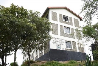
About Us
Mwatate Constituency
Mwatate constituency is one among the 4no constituencies in Taita-Taveta county in coast region Southern part of Kenya.
It borders the other 3no constituencies namely: Voi in the East, Wundanyi on the North and Taveta in the West. The constituency has no physical border with respect to Taveta due to it sharing the Tsavo National Park in between.
Mwatate town is the constituency headquarters is 360Km away from Nairobi city and 181Km from city of Mombasa.
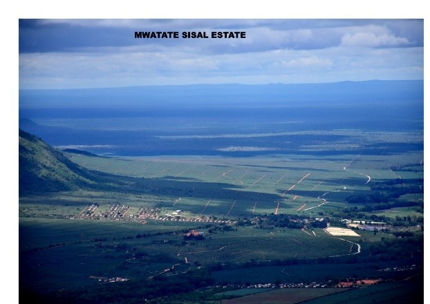
The constituency covers an area of 2849.0Km² with two wild life sanctuaries accounting for a significant proportion of over 600 Km². the constituency also has group ranches and privately owned Teita-sisal estate which ranks among the largest in the world.
Mwatate constituency has two distinct topographical divisions: the hilly area in the north and north east part of the constituency and semi-arid plains that spread in the low lands area of the constituency.
The constituency has 5no wards that serve both as administrative and political units. These are: Mwatate, Chawia, Rong’e, Bura, and Wusi/Kishamba.
In administration there are 10no locations and 29no sub locations.
In term of schools the constituency has 63no of primary schools and 29no secondary schools.
Access NG-CDF Information on your Mobile


County Assembly Wards in Mwatate Constituency :
Mwatate Ward
- County Assembly Ward No.:
- County Assembly Ward Name: Mwatate
- County Assembly Ward Population (Approx.):
- County Assembly Ward Area In Sq. Km (Approx.):
- County Assembly Ward Description: comprises part of
Chawia Ward
- County Assembly Ward No.:
- County Assembly Ward Name: Chawia
- County Assembly Ward Population (Approx.):
- County Assembly Ward Area In Sq. Km (Approx.):
- County Assembly Ward Description: comprises part of
Rong’e Ward
- County Assembly Ward No.:
- County Assembly Ward Name: Rong’e
- County Assembly Ward Population (Approx.):
- County Assembly Ward Area In Sq. Km (Approx.):
- County Assembly Ward Description: comprises part of
Bura Ward
- County Assembly Ward No.:
- County Assembly Ward Name: Bura
- County Assembly Ward Population (Approx.):
- County Assembly Ward Area In Sq. Km (Approx.):
- County Assembly Ward Description: comprises part of
Wusi/Kishamba Ward
- County Assembly Ward No.:
- County Assembly Ward Name: Wusi/Kishamba
- County Assembly Ward Population (Approx.):
- County Assembly Ward Area In Sq. Km (Approx.):
- County Assembly Ward Description: comprises part of